- Find out if your property is in a flood zone with a practical 5-step checklist using official hazard maps, local planning overlays, and real-world flood evidence to validate risk fast.
- Learn what flood zoning and flood overlays can mean for feasibility, approvals, building design, and insurance and financing.
- Even if your property is not in a flood zone, there may still be flood risk. Maps can miss pluvial and access-route flooding, or changing conditions, so cross-check hazard maps with local controls and real-world flood history.
When selecting a development site, planning a subdivision, assessing infrastructure risk, or deciding whether refurbish a building, asking “is my property in a flood zone?” can save months of redesign and a lot of cost.
Flood risk doesn’t just concern homeowners. For municipal planners, developers, architects, builders, and enterprise teams, it affects:
- Feasibility (earthworks, drainage, utilities, access)
- Approvals (planning controls, flood overlays, conditions)
- Design (floor levels, flood-proofing, services placement)
- Insurance and financing (availability, premiums, lending requirements)
- Public safety and reputational risk (evacuation routes, emergency response, asset resilience)
This is a practical, repeatable guide to determining whether an area is flood-prone, with specific details on what to do in the United States, Canada, and Australia. To jump-start your development assessment, the Archistar platform lets you activate various data overlays, including flood zones.
Quick Check: How To Find Out If Your Property Is In a Flood Zone
Pro tip for teams: If you’re assessing multiple sites, use this five-item checklist every time so each project starts from the same evidence-based standpoint.
- Check your country’s official flood hazard map and your jurisdiction’s “effective” map where available.
- Pull the local planning controls: flood overlays, floodplain management areas, minimum floor levels, stormwater requirements.
- Cross-check real-world flood data from historic events, local studies, terrain/drainage, coastal surge exposure, and river and creek proximity.
- Examine and interpret the map for access/egress constraints, floodway vs. flood fringe, depth and velocity of floods, and so on.
- Get a site-specific assessment from a hydrologist, flood engineer, or environmental consultant for help with material cost/safety decisions.

The aftermath of 2024's hurricane Debby in Sarasota, Florida.
What Are Flood-Risk Areas?
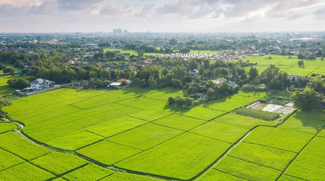
A flood-risk area, or a flood-prone area/flood-risk zone, is a location more likely to flood due to a variety of factors, including heavy rainfall, stormwater surge, river overflow, snowmelt, dam/levee failure, or other conditions. Flood-risk areas span in size from a single street to a whole watershed, and are shaped by both natural and built-environment factors.
Common flood-risk zone characteristics:
- Low-lying terrain, such as floodplains, valleys, and coastal flats.
- Proximity to waterways like rivers, lakes, wetlands, and canals.
- Coastal exposure, due to storm surge, king tides, or wave run-up.
- High-intensity rainfall patterns, which increase flash flooding risk.
- Limited natural drainage because of urbanization and infrastructure.
- Impermeable soil or soil with poor drainage.
- Upstream levees, dams, or detention basins that change water flow paths.
- Drainage pinch points, such as undersized culverts or constrained channels.
How To Check If Your Area Is Prone To Flooding
The following five items are the most reliable methods to find out if your property is prone to floods. They start with the fastest ways to screen an area, and increase in complexity to project-grade confirmation.
1) Your country’s official flood hazard map
United States
- FEMA Flood Map Service Center (MSC) — FEMA’s public source for flood hazard information, supporting the National Flood Insurance Program (NFIP).
- FEMA National Flood Hazard Layer (NFHL) — a geospatial database of current effective flood hazard data covering more than 90% of the US population. NFHL’s county and state datasets are downloadable in GIS file format.
For your due diligence, this map data can supply the flood zone designation for an area. The floodway boundaries and base flood elevation may also be available. Note also the effective map date.
Canada
Canada’s federal, provincial, and municipal organizations all offer flood mapping information. Use these sites to identify which source includes your area.
- Flood Hazard Identification and Mapping Program (FHIMP) — makes high-risk flood hazard maps and other information available in an ongoing program for better flood preparation.
- Canada Flood Map Inventory (CFM) — does not display the actual flood zones, but helps you find and access existing flood hazard maps.
Australia
Flood mapping in Australia is typically strongest at state and local council level. State portals often reveal the controls that affect approvals.
- FloodCheck Queensland — information on floodplains, modeled and historic flood maps, imagery, and reports.
- Australian Flood Risk Information Portal (AFRIP) — Geoscience Australia’s central location for standardized flood data. It contains flood maps and studies from local, state, and territory governments, but only up until 2018.
2) Local government planning controls and flood overlays
Even when there’s national flood planning guidance, local planning controls may better support flood-risk management. For example, New South Wales, Australia recognizes increasing extreme flood events with special considerations. Local flood planning controls may specify:
- Flood planning overlays and flood-prone land controls
- Minimum habitable floor levels
- Fill, compensatory storage, or flood-compatible use requirements
- Stormwater detention/retention requirements
- Flood event access/egress requirements
- Permit triggers for floodplain development
3) Real-world flood behavior
Maps don’t always tell the full story, especially for pluvial flooding related to drainage systems being overwhelmed by rainfall. Look for sources like Australia’s Bureau of Meteorology, which provides flood watch/flood warning services.
Useful real-world flood behavior sources:
- Historic flood imagery and local incident reporting
- Topographic flow paths, low points, and “bathtub” streets
- Drainage network capacity and known problems
- Community and local expert knowledge on what floods first, how fast, and where water goes
- River and rain monitoring for operational awareness

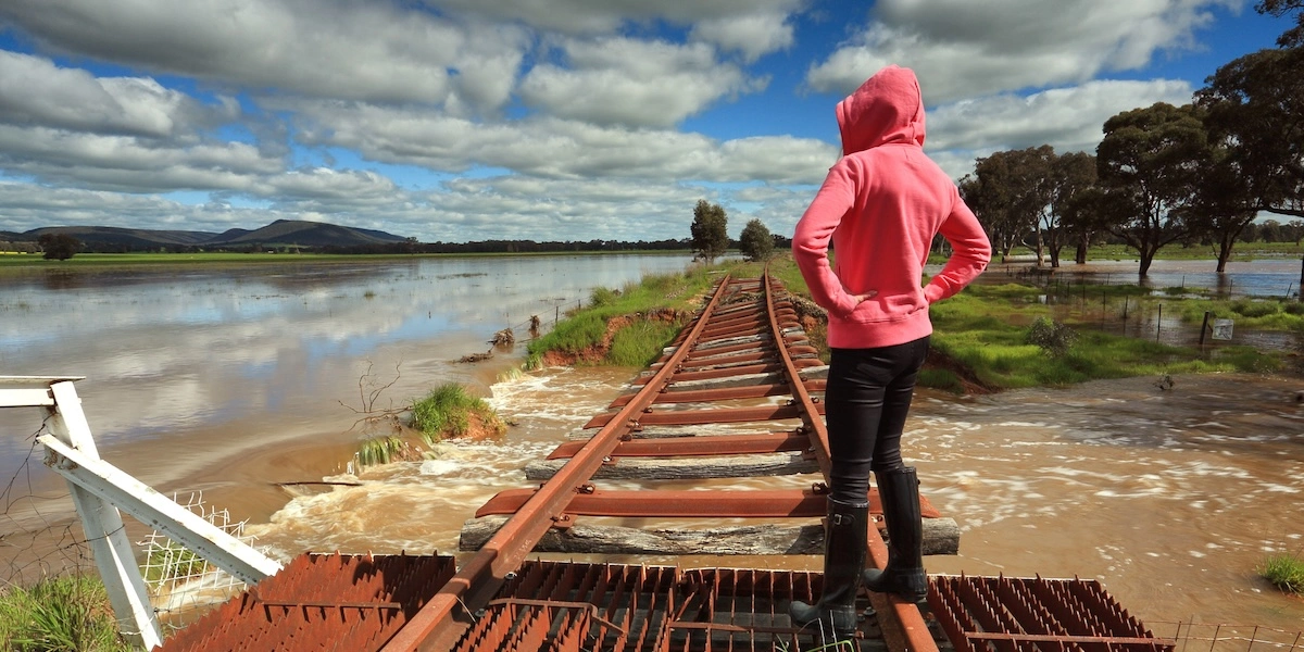
First responders row a couple away from danger after a surging river flooded houses in Montreal, Canada.
4) Talk to insurers and lenders early
If a prospective location sits in a high-hazard area or has experienced flood events repeatedly, ask insurers and lenders about the cost or feasibility of insuring and/or financing it. Don’t consider their input a single source of truth, but get their thoughts early in the process.
5) Commission a site-specific flood risk assessment
Getting a qualified professional assessment is a serious step. Yet, it’s the right step if flood exposure could materially affect safety outcomes, the long-term operation of the property, or the likelihood of gaining permit approvals. It can also inform whether flood risk could require earthworks or changes to the site layout and placement of services like electrical and critical equipment.
Using AI-powered Tools to Screen Flood Risk Fast
Municipal teams like the City of Surrey have described using Archistar AI PreCheck (formerly eCheck) to streamline zoning compliance reviews by checking drawings against bylaws before submission. Archistar’s platform also has many map overlays that you can use to visualize site information, such as flood areas, but also including zoning, fire risk, and contoured or sloped land.
This visualization allows you to instantly assess all the potential risks of your site, as well as to cross-reference them with the local building codes, zoning laws, and risk profiles.
How To Avoid Mistakes When Interpreting Flood Maps and Flood Zones
Don’t be fooled by the term “100-year flood.” That’s called “probability language.”
In the US, FEMA describes Special Flood Hazard Areas (SFHAs) as those with a 1% annual chance of flooding. Australia describes the same concept as Annual Exceedance Probability (AEP).
This means that a “100-year flood” does not mean a flood that happens once every 100 years. Rather, it is a flood with an estimated 1% chance of occurring in any given year. Hence, multiple “100-year floods” could occur within a span of much less than 100 years.
Also remember that an area “outside the zone” does not mean there is “no risk.” FEMA notes that over 40% of flood insurance claims come from outside high-risk flood areas. So besides a property being in a flood-risk zone, planning and development teams should also consider:
- intense rainfall vs. stormwater capacity
- blocked drainage paths
- upstream land-use change and hardening
- basement or cellar vulnerability
- critical access routes that may flood even if your property doesn’t flood
Explained: Flood Hazard vs. Flood Risk vs. Flood Zone vs. Floodplain
While not the same, people often use these terms interchangeably. However, their different meanings matter especially when approvals and insurance depend on precise definitions.

How Flood Zones Are Determined
Natural Resources Canada describes the flood mapping process as involving many experts and many steps, like community engagement, data acquisition, and hazard assessment before actually producing the map.
The details may vary somewhat by country, but generally, flood zones and hazard maps are created using:
- Historical flood evidence
- Topography, often from LiDAR-based terrain models
- Hydrology and hydraulics modeling that shows how rainfall becomes flow and how that flow spreads
- Modeling coastal processes like storm surges and sea level drivers
- Drainage networks and land use
- Community and stakeholder input
What Does It Mean If Your Property Is In a Flood Zone?
If your property is in a flood zone, development may be possible, but the design focus may shift to what’s “approvable” for your jurisdiction and site conditions.
1) Feasibility and cost planning
Developing flood zone property may require flood studies and/or hydraulic modeling. Also expect additional scope, such as earthworks, compensatory storage, and drainage upgrades or detention systems. The minimum floor level may need to be higher, which affects accessibility and may necessitate stairs and ramps. Potential water exposure can dictate materials changes. Finally, you can expect that approvals timelines may be longer.
2) Permitting and compliance conditions
For example, a building permit application for a flood zone property could trigger additional documentation requirements. There are additional compliance conditions, such as minimum floor levels, floodproofing, and limitations on basement/understory uses. You may also be required to maintain overland water flow paths. To get a handle on all the additional compliance conditions, consider improving your permit submission readiness with Archistar AI PreCheck.
3) Insurance and financing considerations
Besides extra permitting requirements, flood zone property may add to the insurance cost or affect insurance availability. Lenders too may have additional concerns or hesitancy to finance the project. You can’t avoid the potential for buyers or tenants to balk at the flood risk, as well.
What To Consider When Building in Flood-Prone Areas
Architects, builders, developers, and municipal reviewers should heed some practical design and approval considerations when building on flood-prone land.
• Safety and emergency management: Know what may happen if the area does flood. For example, could occupants safely shelter or evacuate during a flood? Will a flood isolate access roads or disrupt essential services like power, water, and communications?
• Building and site design fundamentals: Design your flood-prone property to be resilient by elevating habitable spaces and critical utilities above required levels. Flood-resistant materials and assemblies can also mitigate risk. Plan early to include stormwater detention/retention while maintaining flow paths that don’t push water onto adjacent sites. It may also be possible to design more flood-compatible ground floor parking and storage.
• Use recognized standards and guides: These differ by location. For example in the US, ASCE 24 describes how to meet or exceed requirements for flood-resistant structure design and construction in flood-hazard areas. Canada’s National Research Council “Guide for design of flood-resistant buildings” does the same for resisting flood-related damage and operational disruptions.
• Plan a smooth permit approval path: Introduce flood requirements at the concept design stage for best results. When preparing a permit submission, show clearly that you’re not making off-site flood impacts worse, with clear documentation and data sources. Cross-reference your flood and stormwater constraints with zoning and other overlays. You also want to show safe access and egress logic. Archistar AI PreCheck can instantly compare your submission package against local codes and flag any issues for fixing before you submit to the local authority.
How Flood Maps Can Miss Real Risk
A US Government Accountability Office report found that FEMA flood hazard maps don’t always “reflect the best available climate science or include information on some current flood hazards (e.g., heavy rainfall overwhelming storm drainage systems).”
Fixing that problem may take years, so always cross-check riverine/coastal mapping with urban drainage and pluvial flooding evidence, especially in dense cities. And consult any updated datasets and any other local flooding studies you can find. Flood-risk data is an evolving entity. Maps and controls change with new studies, development patterns, and extreme events.
A Scalable Flood Due-Diligence Workflow for Teams
If evaluating multiple sites, standardize a due-diligence pattern:
- Standardize your checklist, including maps, planning controls, validation, interpretation, and escalation.
- Capture evidence, including screenshots, map IDs, effective dates, links, and notes.
- Create a shareable summary for stakeholders that flags risks and notes the next actions.
- Escalate early if flood risk could change feasibility.
Modern AI-powered digital permitting tools can infuse this process with greater efficiency and accuracy to streamline building and zoning permit reviews. Find out how to screen sites and make decisions faster while preparing better submissions by demoing Archistar AI PreCheck.

In the US, the Federal Emergency Management Agency (FEMA) issues flood maps and other flood-hazard information.
FAQ: Frequently Asked Questions About Flood-Risk Property Development
Is my property in a flood zone?
Check to see if it floods near your address using the official hazard map for your country (like the FEMA Flood Map Service Center in the US) and then cross-check local planning overlays and flood studies. Validate those findings with local context, such as terrain, drainage, and historic flood evidence.
What’s the difference between flood risk and a flood zone?
Flood zones are mapped categories used for regulation, insurance, and planning. Flood risk is broader: It considers flood hazard and also the people and assets that are exposed, as well as vulnerability. A site may carry flood risk even if it’s outside a high-hazard zone.
Does “100-year flood” mean it won’t happen again for 100 years?
No. As FEMA explains, a “100-year flood” is a flood with a 1% chance of occurring in any given year. Multiple “100-year” events can happen within a short period.
If a property is not in a high-risk flood zone, is it in the clear?
Oftentimes, no. FEMA notes that over 40% of flood insurance claims come from outside high-risk flood areas. Urban drainage flooding and local bottlenecks can create real impacts even outside mapped high-hazard zones.
Can you build in a flood zone?
In many jurisdictions, yes. However, it may come with additional design constraints, documentation requirements, and conditions. Make a careful decision depending on local flood overlays, flood behavior, and the constraints of your design.
What should professionals use beyond flood maps?
Use a layered approach that includes official hazard maps, local planning controls, and site-specific assessment when needed. Design standards like ASCE 24 in the US are relevant for flood-resistant design requirements.
Sources and starting points by country
United States
Canada
- Flood Hazard Identification and Mapping Program (FHIMP)
- Canada Flood Map Inventory
- Federal Flood Mapping Guidelines Series
Australia
This article is revised and updated from its original version published in August 2023.