Discover real estate potential & invest with confidence
Don’t waste time sifting through thousands of properties. Use our all-in-one property platform to explore real estate opportunities quickly and simply.
- Explore opportunities with advanced search & filter tools
- With one click, get detailed property insights, including build potential and planning restrictions
- Reveal risks such as flood, bushfire, heritage and sloping limitations
- Determine returns by comparing precedents, sales & rental history, and by using our built-in feasibility calculator
- Generate design concepts with AI
How it works
Discover real estate potential

STEP 1
Explore opportunities
- Discover opportunities utilising advanced search & filters tools
- With one click, get detailed property insights, including build potential and planning restrictions.
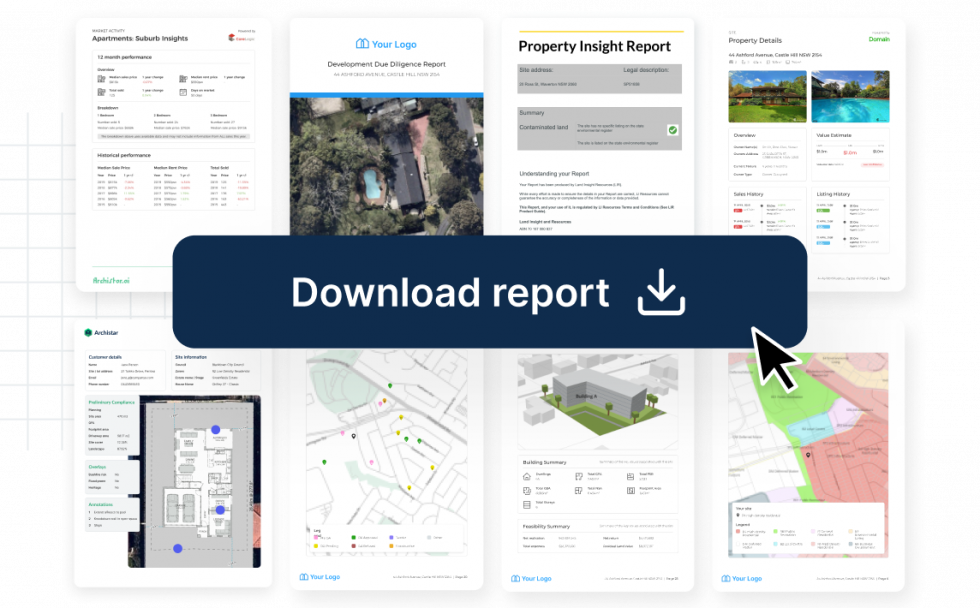
- Instant branded due diligence reports

STEP 2
Reveal property risks & returns
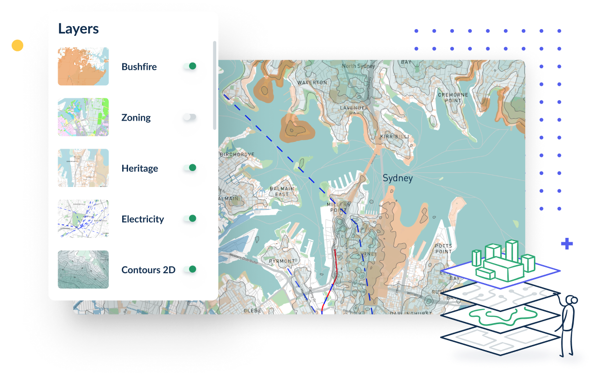
- Reveal risks such as flood, bushfire, heritage and sloping limitations
- Estimate returns comparing precedents and sales & rental history
- Calculate ROI with our built-in feasibility calculator

STEP 3
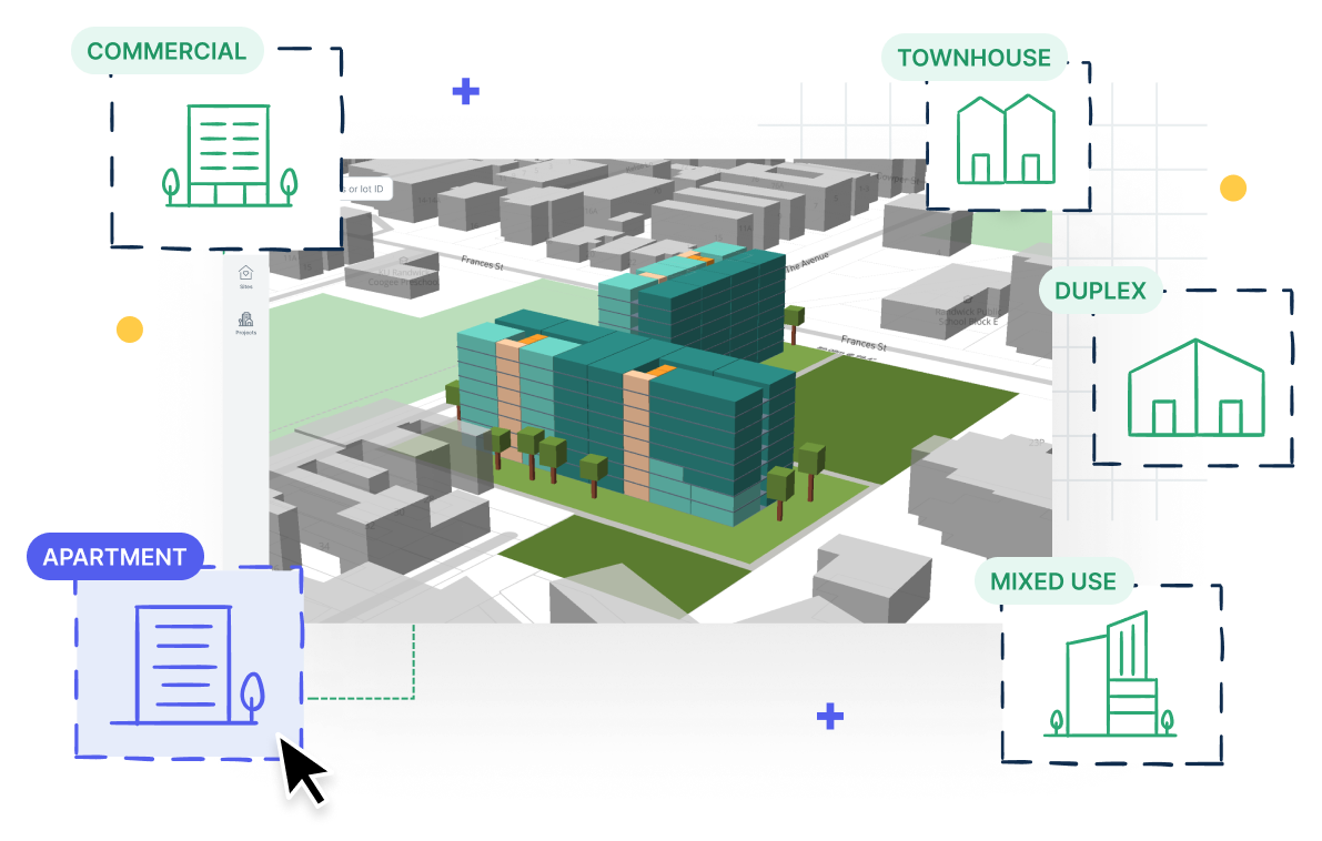
Generate design concepts with AI
- Generate up to 10 building types
- View real time analytics like sunlight, cross-ventilation and ground shadows
- Export your designs in CAD or BIM format
Trusted by industry leaders


Archistar Innovation Labs
We’ve helped build solutions for leading enterprises who have shaped the industry. Talk to us today to explore ways to future-proof your company.
Solve for the future
30x faster
Exponentially faster than
manual site finding methods
$30K saved / project
After quantifying time spent
and consultant costs
10x return
Maximise your investments
with the Archistar workflow
What can I do with a free account?
As a Free Tier user of Archistar, you can make use of the platform as a daily tool for property research. Our objective for the Free Tier is to consolidate complex property data into a single, accessible location. This includes data sets such as zoning codes, planning rules, environmental risks, contours, and property market information that would otherwise require extensive research across multiple websites.
Additionally, you have the opportunity to explore our generative 3D AI designer. With over 6 years of dedicated development, we aim to provide this innovative technology to as many individuals as possible.
Try it out now with a free account.
What can I do with a paid account?
Subscribing to a paid tier on Archistar offers a range of benefits that provide a more comprehensive and extensive experience. With a paid account, you gain access to government rules specific to each building type, which will allow you to navigate complex regulations with ease.
In addition, exclusive Archistar tools and algorithms will assist in identifying nearby precedents and sites with property development potential. These tools provide a unique advantage in finding properties with high development potential, enabling you to make more informed investment decisions.
Furthermore, paid accounts grant access to third-party add-ons, such as Cordell and Nearmap. Cordell is a trusted source of construction data, while Nearmap provides high-resolution aerial imagery that can be used to support property development research.
If you would like to explore this in more detail, create a free account and preview paid features in platform or request a demo from our team.
Can I use Archistar's generative AI designer?
Yes!
Archistar’s generative 3D AI designer is available for use on all package tiers, including the Free Tier. This means that regardless of your account type, you have access to this powerful design tool to enhance your design processes.
However, it’s worth noting that paid tiers offer unlimited usage of the generative AI designer and the added benefit of being able to extract designs into CAD-compatible file formats. This can be especially useful for professionals who need to work with other design software.
Dr. Benjamin Coorey and the Archistar team have invested over 6 years of development into the generative design engine, and we are proud to provide access to as many people as possible. In collaboration with you, we can make AI work more effectively for our industry and help augment existing design processes.
Create a free account, select a site and try out the designer!
What regions are covered by the platform?
The Archistar platform currently covers Australia and all 8 of its states and territories.
Please contact us directly for a private discussion if you are interested in international coverage. We have a number of projects in play with key international partners that we currently can’t disclose.
Where is Archistar's data sourced from?
Our planning, zoning & permitted use data is collected directly from official government documents on a federal, state and local level. We then standardise and catalogue the data to ensure it is presented to our users in an understandable format.
We have partnered with the best in the business for market and development permit data. Domain, CoreLogic, Cordell and Nearmap are a few of our key data partners. View our full list of partners.
What documents can be purchased from the platform?
Title Search documents and Contamination Reports are currently available for purchase on a site-by-site basis. You can view these on any tier, including the Free Tier. Simply select a site and click ‘Download Reports’ to view the documents that are available for the site.
Create a free account and check out the documents on offer.
What is included in an Archistar due diligence report?
The Development Due Diligence (or DDD) is commonly used as a ‘highest and best use’ report, answering the question, “How can I best use this piece of land?”.
The report consolidates and presents almost everything that the Archistar platform has to offer. This includes planning details, applicable layers, market details, suburb insights, nearby developments, generated designs, analysis on designs and feasibility on designs. This report is customisable and white-labelled, meaning you can insert your name and brand to download and present to clients and/or stakeholders.
A sample can be viewed in platform. Create a free account to check it out!
